Introducing Jeremy Crampton
 Jeremy Crampton is Associate Professor of Geography at the University of Kentucky.
He received his PhD from Penn State University in 1994, and has since held positions in the UK and US (previous one was at Georgia State University). The research interests of dr Crampton include political representation of space, especially through mapping and GIS. More specifically, he studies the historical genealogy of spatial and geographic knowledges, and contemporary developments in the spatial geoweb.
For more information about his work, please check the Blog by Jeremy Crampton.
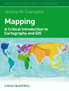
This is part 1 of an interview in which dr Crampton elaborates on his book “Mapping: A Critical Introduction to Cartography and GIS”. Part 2 is Jeremy Crampton: Cartography, human perception, cognition, spatial geoweb
Interview
The book “Mapping: A Critical Introduction to Cartography and GIS”
Why have you written the book?
I was actually asked to write the book some years ago by John Paul Jones as part of the Blackwell (now Wiley-Blackwell) critical geography series.
The book was meant as an introduction to critical cartographic approaches that have emerged over the last twenty years, as surprisingly there is no single book on that topic. It took me a while to get going, but I eventually finished it in 2009!
Why do you take a critical approach towards cartography?
Like most geographers I have a fascination with maps. For most of my life this was simply as a user and “uncritical” consumer.
The British Ordnance Survey maps for example, are marvellous for perusing or hiking. I grew up in Chester, so North Wales was nearby and as a boy my family visited there quite often. The Landranger map of Snowdonia for example is an incredible document of closely spaced contours, rocky pathways and precipitous drops.
We used to stay in a family friend’s cottage in Dolwyddelan, in the Lledr Valley in Snowdonia. All around was this incredible countryside with glacial rock deposits, small intricate streams and abandoned slate mines. The maps of this area somehow managed to capture something of that.
But for me there was always something a bit missing if you just thought of the map coming second after the landscape. It seemed more intimately involved in that, as if the map were part of the experience of landscape itself.
Later in grad school reading the work of Brian Harley and Denis Wood I found some ways that this co-creation so to speak might be thought through.
Geographic Information Systems, geovisualization and mapping technology
What are Geographic Information Systems (GIS) and why is it an issue whether GIS is part of cartography or the other way round?
GIS is the software and hardware for acquiring, visualizing and analyzing geospatial data. It was originally developed in the 1960s (Esri for example was founded in 1969) for natural resource management, but has today expanded far beyond that. People sometimes ask if it’s tool, methodology, or ideology, and of course it can be all three. In the book I discuss mapping and GIS as political technology of government. It can be differentiated from GI Science, which is the larger project of geographic enquiry and understanding.
It’s very noticeable how GIS tends to suck up the oxygen when talking about mapping, marginalizing cartography. So if you open a GIS text, you will see and understand cartography as something to do with map design and symbolization, and possibly map types.
If you’re a cartographer, the issue is probably reversed. If the question is considered historically, you can situate GIS as the modern instantiation of the practices of mapping.
The same for geovisualization, which cartography attempted to appropriate as a term for itself. All of these are valid, to some extent.
I think if people had that historical understanding, and the appreciation of contingency that it affords, there would be less need to make definitive pronouncements about one being part of the other. After all, GIS will probably be dead or at least very different in ten years!
How has the study of map users evolved and what are its main results?
I think you can see this best in the emphasis on mapping as part of everyday lives. Ethnocartographies if you like.
Instead of studying people reading maps in the lab, we now are interested more in mappings as a process, especially in the everyday lived level. Some of this is reminiscent of the behavioural interests of the 1980s in geography, but I think with a more political inflection.
What are the main consequences of the increased access among non-experts to mapping technology (e.g. Google Earth)?
I think you’ll get what I previously mentioned. Simultaneously an expansion of the creation of geographic knowledges, and attempts to discipline who and what knowledges can count.
For a parallel, look at Wikipedia and the reaction of some schools or departments at least to disallow it as a source, even as it completely eclipses the Encyclopedia Britannica in size.
An example closer to cartography is OpenStreetMap, which is an attempt to map the infrastructure of the world, especially its road networks and buildings. Since anybody can contribute to it there are worries that the information is wrong. But it’s already proved its worth, for example in helping relief efforts in Haiti after the earthquake.
Now you’ll notice that it’s a standard base layer in Esri’s ArcGIS Online! And actually formal studies have shown OSM is not significantly less accurate than the Ordnance Survey, though I think this kind of comparison needs further work.

